Students at a Lincoln City summer camp recently applied their burgeoning skills and the latest mapping technology to a unique work-study project that will ultimately assist the Port of Newport in future improvements.
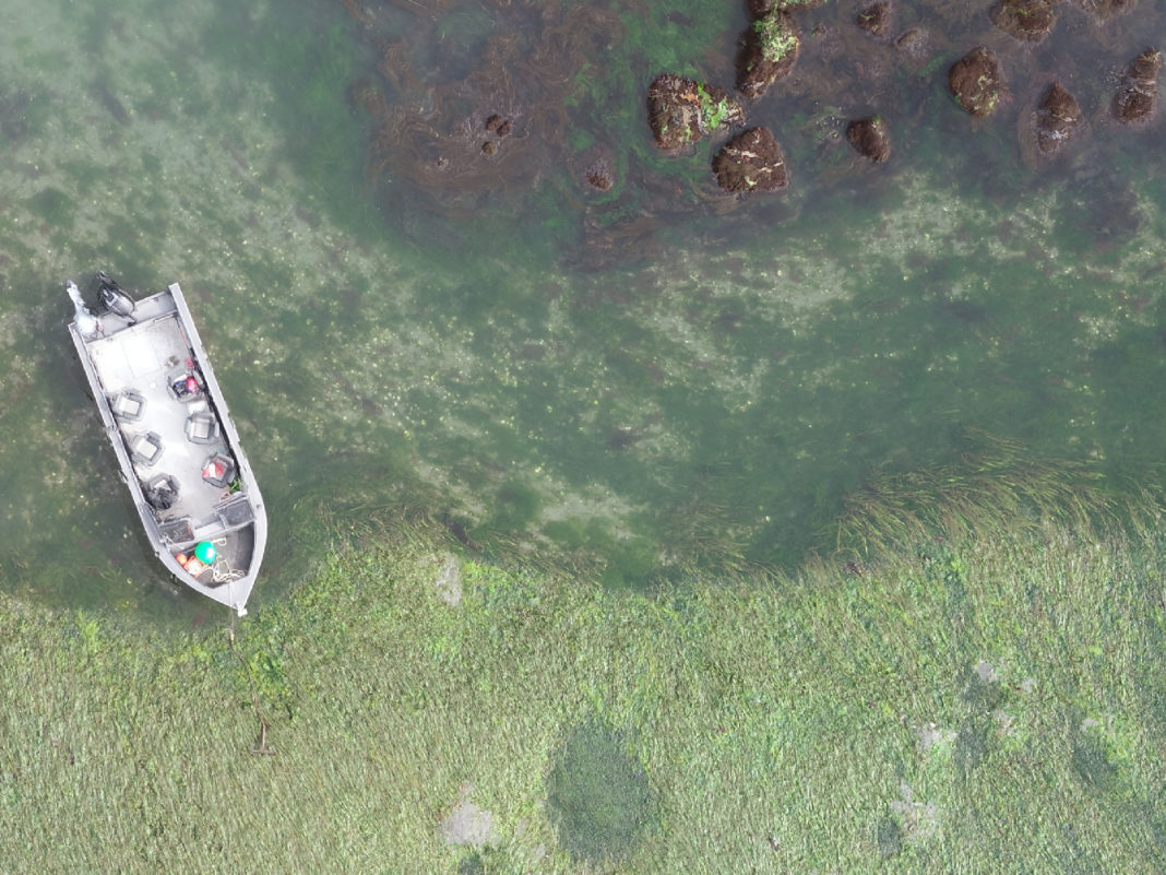
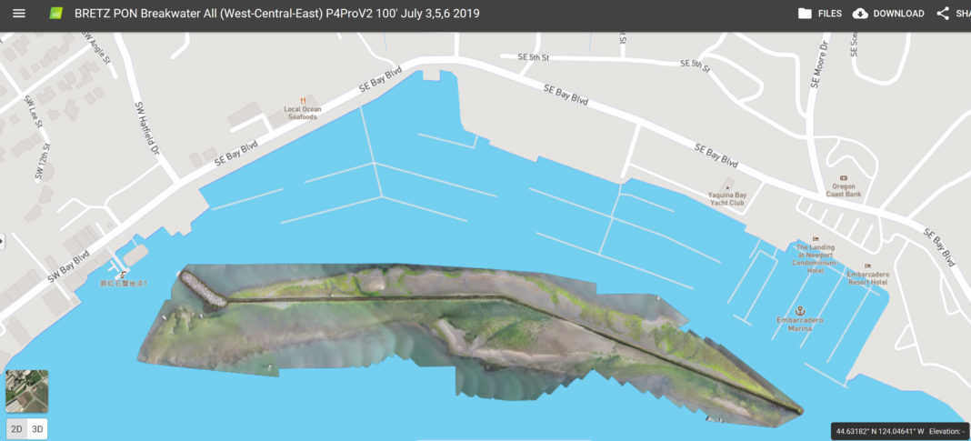
Over the course of four sessions earlier this month, students from the Coastal Drone Academy (CDA) utilized aerial drones to capture images of eelgrass beds along the commercial marina sea wall and imported the data into mapping software. The results will play an important role in future dredging projects around the bustling marina.

“Development of Port property is only possible if the Port can mitigate for the environmental impacts of those development efforts,” explained Director of Operations Aaron Bretz. “The Port must make a concerted effort to learn about where eelgrass exists and where it doesn’t exist so that we can then determine what sort of changes can be made to our facilities. The data is vital to the Port’s planning efforts for years to come.”
CDA is part of Career Tech High School, a public charter school located in Lincoln City. The Community Services Consortium holds the charter for the institution that adopts technology-based workplace simulation to prepare students for a successful future.
Dr. Chuck Getter, CDA Instructor, worked with his students to map the entire length of the sea wall, both inside the harbor and in the outer area, during the lowest tides of the year. First referencing historical images, the student drone operators knew precisely where to fly the robotic cameras to capture the needed images. Some students have already obtained a commercial license to operate drones, while others are close to that achievement and gained vital practice time.
Every summer camp outing is a learning experience, Getter said, and since the commercial marina lies within the approach pattern for the Newport Municipal Airport, it is deemed controlled airspace by the Federal Aviation Administration (FAA).
“They learn about FAA airspace and the regulations of flight, how to file a flight plan with FAA, and if the FAA were to show up, they will want to see inspection records and know whether you are aware of any temporary flight restrictions in your area,” he explained.
CDA students learn how to build and care for drones, how to operate them safely, how to abide by the extensive rules and regulations surrounding drone operation, and how to demonstrate their proficiency with multiple aircrafts.
Earlier in his career, Getter worked as a consultant doing environmental impact assessments for governmental agencies and capturing this kind of imagery involved film photography taken from an airplane. “What used to take me weeks or months, I can get up in the air and produce in days,” he remarked.
From the Port’s perspective, the work of these students and their instructor will also represent a cost savings on future projects.
“CDA is providing us with data the Port would be required to provide in future permitting efforts,” Bretz explained. “In order to obtain that data, the Port would have to hire an outside firm to gather information. The Port will be able to use this data to reduce the cost of future feasibility studies and permitting efforts while providing an opportunity for local high school students to hone their skills as drone pilots and data specialists.”
CDA is in its third full year. The Port project was part of coursework in the area of coastal zone management. To learn more about the academy, visit https://coastaldrone.blog/


