 According a news release from Adventist Health Tillamook, “
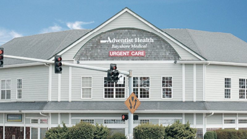
Due to long-standing challenges with provider staffing, Adventist Health has announced the closure of its medical offices in Sheridan, Welches and Lincoln City.
These closures are due to the years-long efforts and difficulty recruiting qualified providers in these rural communities. “We have faced significant challenges with not only recruiting but retaining providers in these areas, even working with national and renown recruiting firms with a high track record of success have not helped the situation,” said Eric Swanson, President of Adventist Health Tillamook.
The clinic in Lincoln City will close on April 12, Hoodland in Welches on April 1, and Sheridan on March 17.
All affected associates and providers have been notified and will be offered to apply for employment opportunities within the Adventist Health system, including positions local to their current locations.
Swanson emphasizes, “This decision reflects no shortfall in the dedication or service of our affected associates. We are immensely grateful for their unwavering commitment to our mission.”
The closure dates and last day for staff at each location are as follows:
• Sheridan clinic will close on March 17, 2024, last day for clinical staff in office April 1, 2024.
• Hoodland clinic (Welches, Oregon) will close on April 1, 2024, last day for clinical staff in office April 15, 2024.
• Lincoln City clinic will close on April 12, 2024, last day for clinical staff in office May 1, 2024.


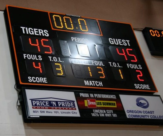 In an exciting back and forth 3A playoff match Tuesday night between the Taft Tigers boy’s Varsity basketball squad and Amity High Warriors the contest settled into a tie at the end of four quarters.
 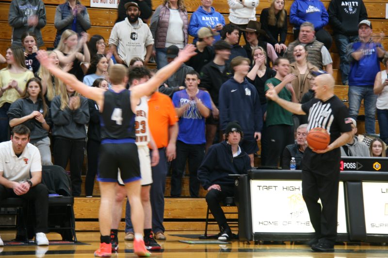 As the teams of teens readied themselves for what each surely hoped would be a victory, they entered the overtime (OT) period before a loud and raucous crowd at the Taft 7-12 gymnasium.
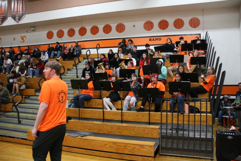 The Tiger band was in top form with energizing music that kept the fever pitch going until the very last second expired on the digital scoreboard.
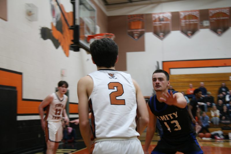 From the OT tip off the Tigers struggled to mount a coordinated offense giving up rebound after rebound from missed shot opportunities. With exception of a crowd pleasing three pointer the boys from Taft’s would not score again.
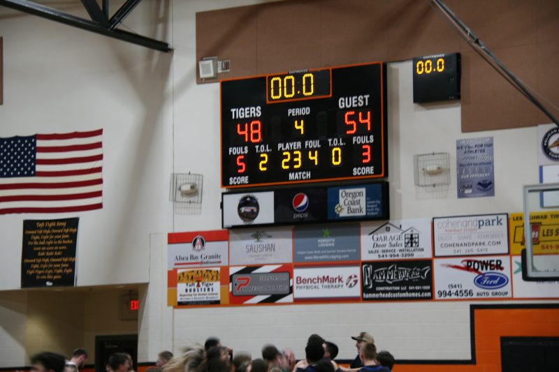 The Warriors did not fare much better in open court with their victory margin coming at the hands of consistent foul shooting.

 WILSONVILLE February 9, 2024 – The Oregon Athletic Officials Association and the Oregon School Activities Association are recruiting officials for the high school spring sports seasons. There is an immediate need for umpires in baseball and softball.
  According to a press release form the Oregon Health Authority, ”

 Marine Corps veteran and local business owner Don Gomez announced his campaign for Lincoln County Commissioner, Position 2 on Friday, February 6.