The Lincoln City Chamber of Commerce wishes to congratulate the nominees for 2018 Business of the Year.
These businesses have been recognized for their outstanding service and/or products, their commitment to the community and their positive impact on the local economy.
The Chamber Board of Directors will pick one winner and they will be announced at the Community Days Banquet on April 21 at Chinook Winds Casino Resort.
For tickets or for more information, please call 541-994-3070.
Last year’s winners were Taft High School for all of the additional fund raising they do throughout the year, and Charlotte Lehto Farmer’s Insurance for everything she gives back to the community on a continual basis.
Last week the Lincoln County Board of commissioners approved a lease between the Curry Family Trust and Lincoln County for property located at on SE Bay Blvd in Newport for a Veterans Services office. County Council Wayne Belmont explained money for the space is available through the state from voter approved funding. The space is located on the left side of Bay Blvd across the parking lot from the county OSU building.
Mr. Belmont explained what the expanded services for Veterans will look like with this new veterans services center. ” The expansion of services would allow outside consultants including doctors and others to come in and do an examination or review of veterans who are applying for benefits.” He added “this will allow the services to come to the veterans rather than the veterans having to go out to the services.”
Commissioner Bill Hall stated “this will be a great step forward for providing additional services to our county veterans.” He added “when I first took office he asked to become the liaison for the county veterans services and I am proud to see this program be able to grow.” In 2005 the county had one veterans services officer and now the county has two people working full time and a front desk person.
Now he added with this extra money from the state they will be able to hire a third person part time to work with veterans in Lincoln City. It was pointed out that Lincoln County could become a model for other areas showing what can be accomplished to help veterans.
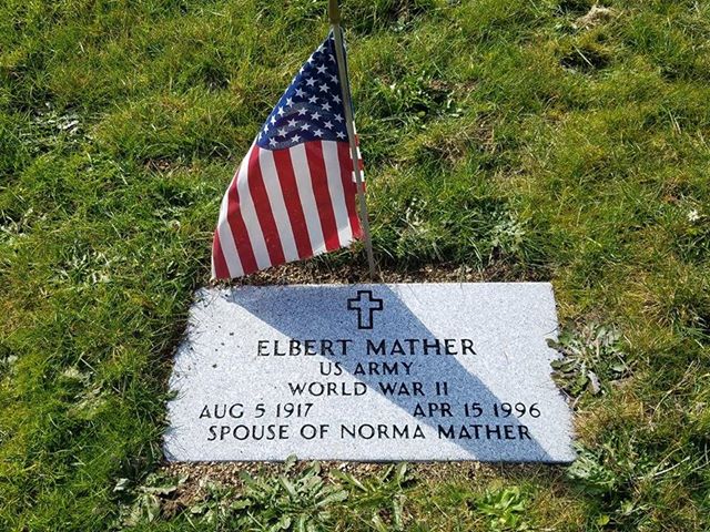
Lincoln City, OR – Pacific View Memorial Cemetery has heeded the concerns of local Cub Scouts and accomplished its mission of honoring our military Veterans by marking the graves of the unnamed fallen.
New Pacific View Location Manager Guinevere Crispin said members of Cub Scouts Pack 47, who had come to plant flags for Veterans at the Lincoln City cemetery, asked why some of the headstones were blank. Crispin flew into action. She tracked down the necessary discharge papers and ordered military markers in the soldiers’ honor.
Crispin said she wants people to know that Veterans are entitled to military markers when buried in a private cemetery. A common misconception is that Veterans must be buried in a military cemetery to be recognized. The military does not pay for installation of markers in private cemeteries, but it does grant acknowledgement of Veterans who are honorably discharged.
Retired Cpl. Nicholas Carton, from Neskowin, heard of the Scouts’ concerns and paid to have the markers installed.
Carton is a veteran Marine who served from 1967 to 1973 in Aviation Electronics working on the A-4 Skyhawk. When asked why he offered to pay for the markers, he said, “It’s what we do. As former active Marines, it’s our responsibility. It’s time for payback.”
Crispin contacted the Honor Guard, who will provide two active duty military personnel to raise the flag Friday, May 25, at Pacific View Memorial in honor of the following Veterans:
Samuel Robert Chorneau (Oct. 2, 1923-June 16, 1994). Chorneau was in the U.S. Army and served in World War II. He was the father of Shawn Chorneau, who died the same year and is buried with his father.
Elbert Mather (Aug 5, 1917-April 15, 1996). Mather was in the U.S. Army and also served in WWII. His marker says he was “spouse of Norma Mather,” who is buried with him.
The public is encouraged to attend the ceremony, which will begin at 11 a.m.
Pacific View Memorial has been nominated for Business of the Year for Lincoln City by the Lincoln City Chamber of Commerce.
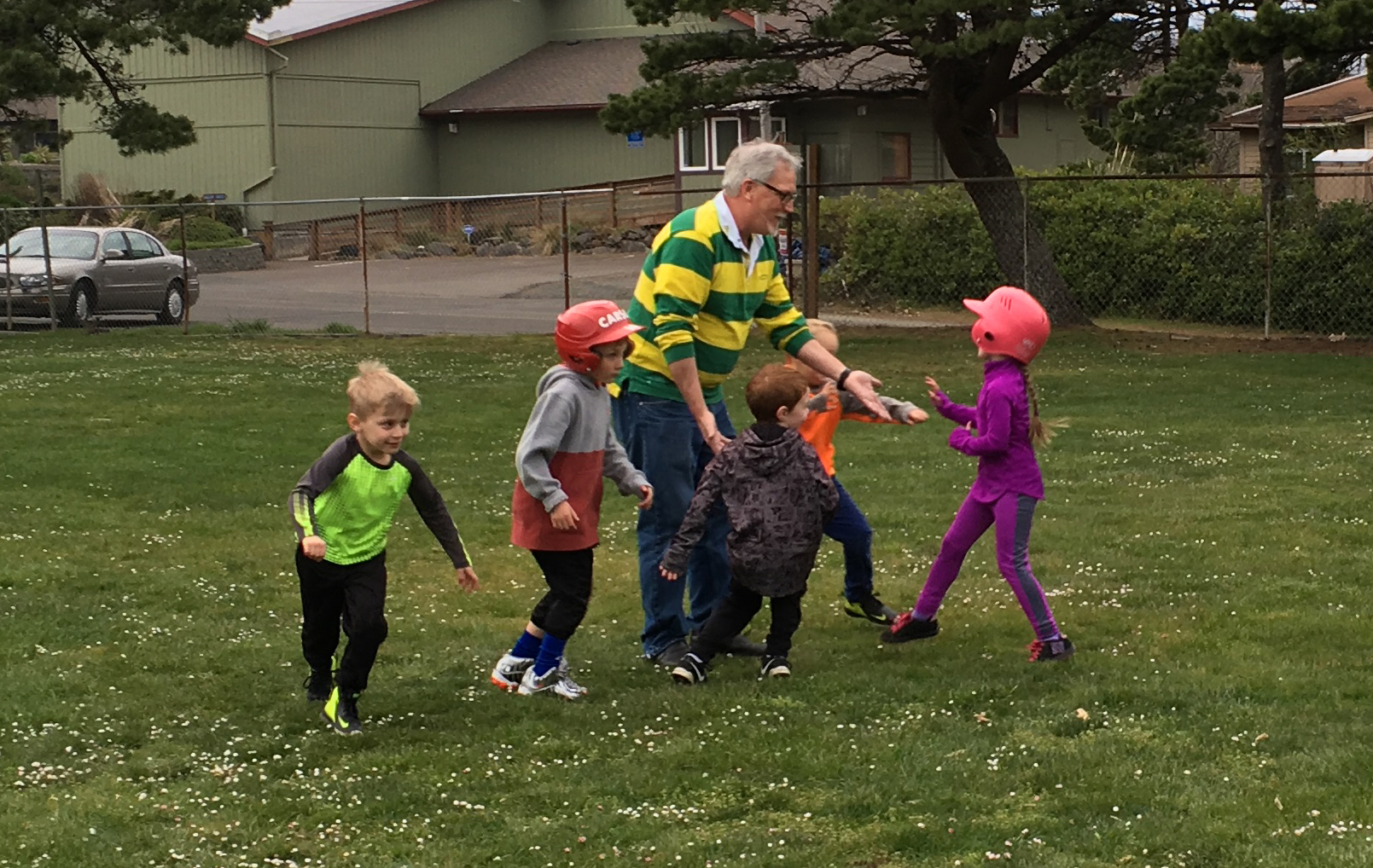
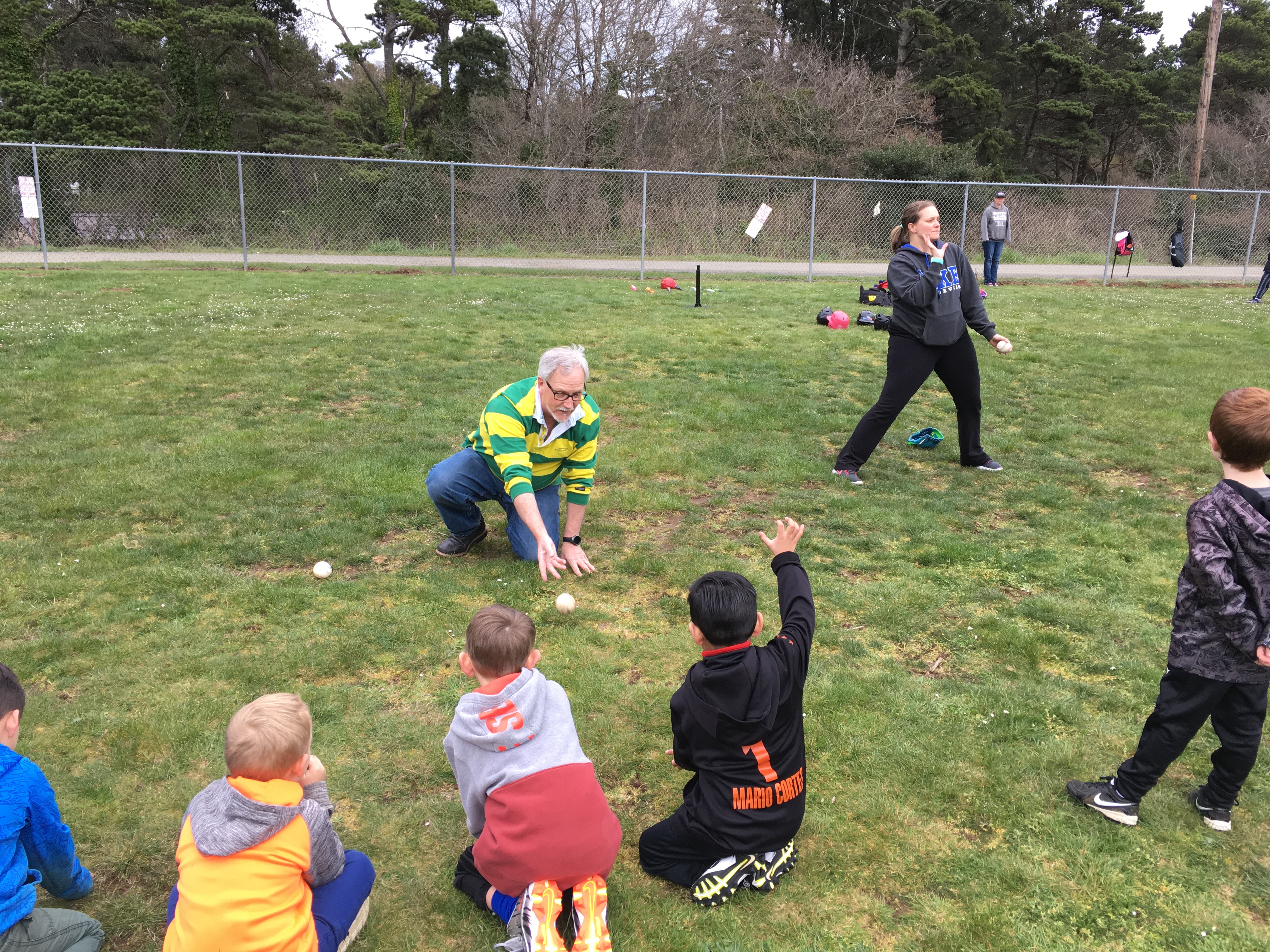
Lincoln City, OR – The Lincoln City Youth League ran a Facebook post recently highlighting a shortage of coaches due to an unexpectedly large turnout for T-Ball. Lincoln City Mayor Don Williams answered the call with the reply, “I’d be happy to help.”
The first practice for new T-Ball Slugger League coach Williams’ Gray Wolves was held at the Lincoln City Cultural Center field. Players ran through a series of drills like the “Alligator Clap,” which showed the concept of fielding ground balls. Another fundamental to learn was to roll a ball back and forth with a teammate. There were very few passed balls, and the kids stayed focused, not only on Williams, but his daughter-in-law, Becky Williams, the assistant coach. The two of them held the team’s short attention span very well.
The 5- and 6-year-olds displayed a willingness to learn that could only be called eager. No kids wandered away from the area. Parents watched intently as the practice progressed, and it could be heard in the crowd that the Mayor was doing a great job as coach.
When asked why the team wasn’t named the “Sandwich Artists,” Williams broke into laughter. “That would have been great,” said Williams, who owns the local Subways. The decision to name the team the Gray Wolves came from Alejandro. As soon as he said it, the team name was passed by unanimous decision.
When asked why he decided to offer his leadership skills as a T-Ball coach, Williams replied, “I just wanted to make sure the kids could have a team.”
HIGH WIND WARNING REMAINS IN EFFECT UNTIL 10 AM PDT SUNDAY
LATEST ALERT 1:34PM
URGENT - WEATHER MESSAGE
National Weather Service Portland OR
134 PM PDT Sat Apr 7 2018

.The strongest winds have been delayed a bit. An occluded front
moved through earlier this morning with a modest burst of wind,
but stronger winds are expected with the bent back occlusion
associated with the low center expected to begin moving onshore
this afternoon and moving through the forecast area tonight and
early Sunday.

ORZ001>004-WAZ020-021-081200-
/O.CON.KPQR.HW.W.0006.000000T0000Z-180408T1700Z/
North Oregon Coast-Central Oregon Coast-
Coast Range of Northwest Oregon-
Central Coast Range of Western Oregon-Willapa Hills-
South Washington Coast-
Including the cities of Astoria, Cannon Beach, Tillamook,
Netarts, Pacific City, Lincoln City, Newport, Cape Foulweather,
Yachats, Florence, Vernonia, Jewell, Sunset Summit, Lees Camp,
Trask, Grande Ronde, Burnt Woods, Tidewater, Swisshome, Veneta,
Willapa, Frances, Elk Mountain, Ryderwood, Raymond, Long Beach,
Ocean Park, Naselle, Cathlamet, and Cape Disappointment
134 PM PDT Sat Apr 7 2018

...HIGH WIND WARNING REMAINS IN EFFECT UNTIL 10 AM PDT SUNDAY...

* COASTAL WINDS...Beaches and headlands...South 30 to 40 mph with
  gusts 60 to 70 mph. Coastal communities...south 25 to 35 mph
  with gusts 50 to 60 mph.

* COAST RANGE WINDS...South 30 to 40 mph. Gusts 60 mph. Winds
  strongest on exposed ridges and west slopes.

* TIMING...Through Sunday morning. The strongest gusts will
  occur this afternoon and tonight.

* IMPACTS...These winds will be strong enough to cause tree
  limbs to fall and possibly topple trees and power lines. Power
  outages are possible. Travel will be difficult, especially for
  high profile vehicles and while crossing coastal bridges.

PRECAUTIONARY/PREPAREDNESS ACTIONS...

A High Wind Warning means hazardous weather conditions of strong
and damaging winds are imminent or highly likely in the warning
area.
OLD ALERT 4:05AM
The National Weather Service in Portland has issued a High Wind
Warning, which is in effect from 4 AM to 8 PM PDT Saturday. The
High Wind Watch is no longer in effect.

* COASTAL WINDS...South 30 to 45 mph with gusts to 75 mph at the
  beaches and headlands, and gusts to 65 mph in the coastal
  communities.

* COAST RANGE WINDS...South 30 to 45 mph. Gusts to 70 mph on the
  exposed ridges.

* TIMING...Windy from early Saturday through Saturday evening.
  The strongest gusts occur from daybreak Saturday through early
  afternoon at the coast. Strongest gusts may continue though
  the early evening across the Coast Range.

* IMPACTS...Winds could damage trees and power lines. Local
  power outages are possible. Travel may be difficult,
  especially for high profile vehicles across coastal bridges.

PRECAUTIONARY/PREPAREDNESS ACTIONS...

A High Wind Warning means hazardous weather conditions of strong
and damaging winds are imminent or highly likely in the warning
area.
PREVIOUS ALERT 2:48PM
HIGH WIND WATCH REMAINS IN EFFECT FROM LATE FRIDAY NIGHT
THROUGH SATURDAY EVENING...

* COASTAL WINDS...South 30 to 45 mph with gusts to 75 mph at the
  beaches and headlands, and gusts to 65 mph in the coastal
  communities.

* COAST RANGE WINDS...South 30 to 45 mph. Gusts to 70 mph on the
  exposed ridges.

* TIMING...Windy from early Saturday through Saturday evening. The
  strongest gusts occur from daybreak Saturday through early
  afternoon at the coast. Strongest gusts may continue though the
  early evening across the Coast Range.

* IMPACTS...Winds could damage trees and power lines. Local power
  outages are possible. Travel may be difficult, especially for
  high profile vehicles across coastal bridges.

PRECAUTIONARY/PREPAREDNESS ACTIONS...

A High Wind Watch means hazardous high wind conditions are
favorable in and close to the watch area in the next 12 to
48 hours.
————————————————————
PREVIOUS ALERT
A strong storm system is expected to develop rapidly while moving
across the northeast Pacific Friday, making landfall near
Vancouver Island Saturday. This system may rapidly develop a
second, equally strong low pressure center precariously close to
the Oregon and Washington Coast early Saturday morning, which
would lead to a very windy day Saturday across southwest
Washington and northwest Oregon.
For now, be advised that there is the potential for strong and
damaging winds Saturday throughout southwest Washington and
northwest Oregon. While the threat is greatest along the coast as usual, there is also the potential for strong winds inland if the
low pressure system tracks close enough to the coast. Impacts may
include downed trees, branches, and power lines, leading to
potential power outages Saturday, even for inland areas.
Now would be a good time to ensure you are prepared for the
impacts of a wind storm. Secure loose outdoor objects, make sure
you have a flashlight and plenty of batteries in case power
outages do occur Saturday afternoon and evening.
Details remain uncertain, and a lot can still change with the
forecast track of this storm and its expected impacts. Stay tuned
to the latest forecast by visiting weather.gov or your favorite
source of weather information.
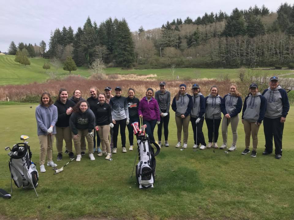
Taft High senior Maya Hatton shot 42 to earn medalist honors, while Newport’s Judy Shu carded a 48 for second Tuesday in a casual nine-hole golf outing at Chinook Winds Golf Resort.
“It wasn’t her best game, but everyone is still working the kinks out after a week of spring break,” Hatton’s coach and mother, Heather, said.
The Lady Tigers shot 199 and Newport 267. Three Waldport High players also competed.
Violet Palermini shot 50 for Taft, Olivia Baker 52 and Sammy Halferty 55.
“Those are all good scores for us after coming back from spring break,” Hatton said. “I’m very excited about how Noa Stoll and Hannah Weaver are hitting the ball right now, and look forward to giving them some varsity opportunities.”
Taft returns to action Monday, April 9, at Creekside Golf Course in Salem.
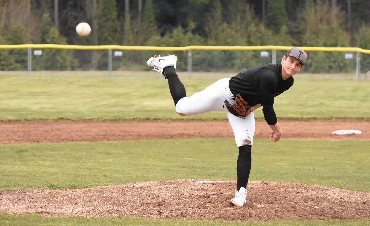
Some might say “Jack is back,” but others insist he never left.
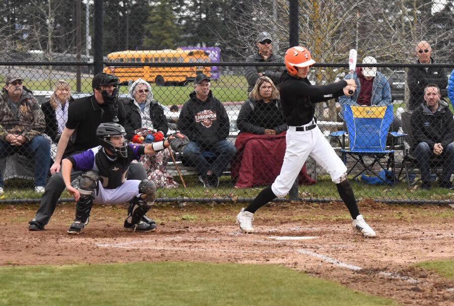
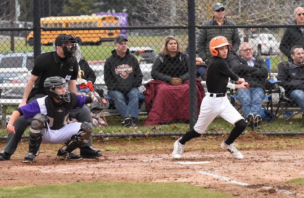
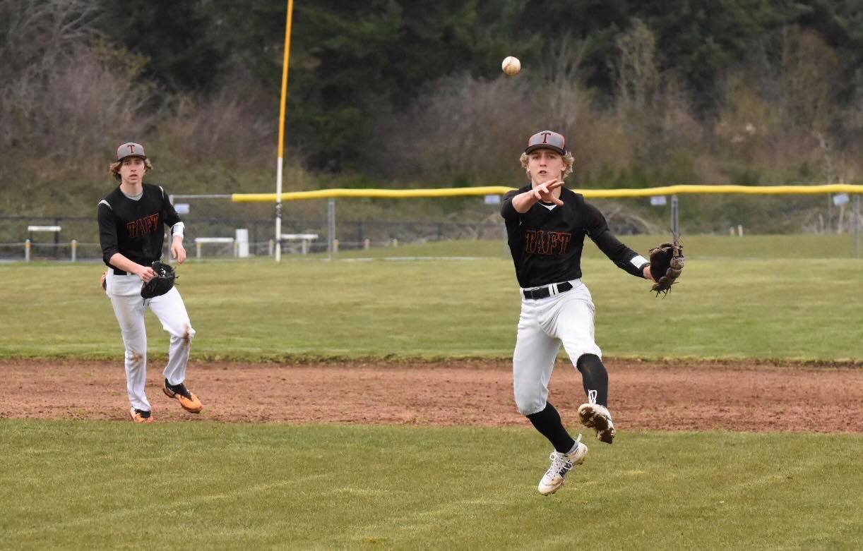
Senior ace Jack Stempel, returning to the mound this season following a serious leg and ankle injury, went the distance and doubled in a run Tuesday to lead Taft High to a 4-1 West Valley League victory over Horizon Christian-Tualatin in a battle of top-five ranked baseball teams.
“We came into a tough environment field-wise and came out on top,” Taft Coach Matt Hilgers said. “We had a great pitching performance and managed to get some timely hits that propelled us to the win.”
Tyee Fisher
Junior outfielder Tyee Fisher doubled in two runs in a four-run fifth inning that broke a scoreless tie, while senior outfielder Caleb King also doubled and drove home a run for the Tigers (9-2, 2-0 West Valley), who took over the state’s top ranking with the win.
Caleb King
“We played really good as a team tonight, and the guys were huge in the field,” said Stempel, who broke his right fibula and tore ligaments in his ankle before last season’s opener while sliding into second. “Horizon was making contact with the ball, but we played great as a team and our defense was outstanding.”
The fifth-rated Hawks (5-3, 0-1) tallied a lone run in the bottom half of the inning off Stempel, who scattered six hits, struck out five and walked none
“My curveball was working a little better tonight than it was in the last game against Crook County [an 18-9 nine-error, nine-walk loss Thursday to open the Madras spring break tournament],” Stempel said. “After we scored those four runs in the top of the fifth, I was able to relax a little because I had a good cushion.”
Starter Sam Romero suffered the loss for Horizon Christian.
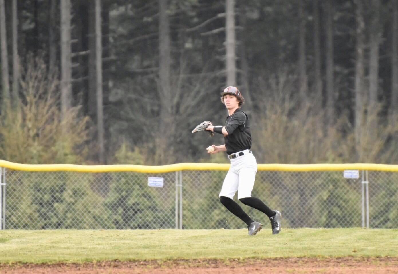
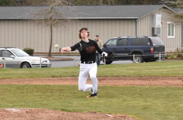
“We did a much better job playing on a dirt infield than we did last week, fundamentally speaking, and it showed as we limited our errors tonight,” Hilgers said.
Kam KesslerTrenton Fisher
Cody Knott led Taft with two hits, while fellow junior infielder Kam Kessler and sophomore outfielder Trenton Fisher had one each.
Senior leadoff hitter Josh Salsbery drew a walk and scored a run for Taft, while cleanup hitter Stempel, King and Knott also scored for the Tigers.
Josh Salsbery
Senior catcher Nathan Brucker and sophomore shortstop Cade Tillema led Horizon Christian with two hits apiece.
Sophomore third baseman Luke Klein scored Brucker with the Hawks’ only run.
The Tigers return home at 4:30 p.m. Friday, April 6, to meet Amity (3-2, 2-0) in league play.
“We will look to build on this win to finish off the week,” Hilgers said.
Taft 4, Horizon Christian 1
TAFT AB R H BI
Josh Salsbery 3 1 0 0
Eli DeMello 2 0 0 0
Caleb King 3 1 1 1
Jack Stempel 4 1 1 1
Cody Knott 4 1 2 0
Kam Kessler 4 0 1 0
Tyee Fisher 3 0 1 2
Bleiz Kimbrough 3 0 0 0
Trenton Fisher 3 0 1 0
TOTALS 29 4 7 4
HORIZON CHRISTIAN AB R H BI
Luke Klein 3 0 1 1
Greyson Pihas 3 0 0 0
Brannon Macfarlane 3 0 0 0
Sam Romero 3 0 0 0
Nathan Murrell 3 0 0 0
Anthony Petit 3 0 0 0
Nathan Brucker 3 1 2 0
Cole Armstrong 3 0 1 0
Cade Tillema 3 0 2 0
TOTALS 27 1 6 1
TAFT 000 040 0 — 4
HORIZON CHRISTIAN 000 010 0 — 1
LOB–TAFT 8, HORIZON CHRISTIAN 5. ERR—Kam Kessler, Luke Klein, Anthony Petit. 2B–Tyee Fisher, Jack Stempel. HBP–Caleb King, Eli DeMello. SB–Cody Knott.
TAFT IP H R ER BB SO HR
Jack Stempel (W) 7.00 6 1 1 0 5 0
HORIZON CHRISTIAN
Sam Romero (L) 6.00 6 4 1 2 4 0
Luke Klein 1.00 1 0 0 0 2 0
PB–Nathan Brucker (2). BALK–Sam Romero. BB–Josh Salsbery, Eli DeMello.
NOTES: The No. 1-ranked Taft High softball team will return to action at home at 4:30 p.m. Friday, April 6, for its West Valley League opener against eighth-rated Amity (4-3). The Lady Tigers (6-5) won their first six games of the season before dropping five straight against bigger California and Nevada schools during a spring-break tournament last week near Napa, Calif. . . .The Taft boys and girls track and field teams will return to competition Thursday, April 5, for a West Valley League meet at Dayton. The Tigers will compete Saturday, April 7, in the Mark Dean Tillamook Invitational before hosting a league meet Tuesday, April 10, at Voris Field. . . . The Tigers boys golf team is scheduled to compete, Monday, April 9, in the Trysting Tree Open in Corvallis. The girls are scheduled to compete Monday, April 9, at Creekside in Salem.
I have been driving Highway 101 for almost 40 years and have recently observed a lot of drivers using their cell phones while driving, with no concern for others. They must know it is against the law.
This spiked my concerns enough that I requested, through a ‘public records request’, the number of citations that were issued by the Lincoln City Police Department in 2017 for illegal use of cell phone while driving. The report showed that 16 citations were issued for that entire year. This averages out to 1.3 citations per month.
The police department has 26 officers on the streets and a $4 million budget.
What do you think?
The National Safety Council reports that:
. cell phone use while driving leads to 1.6 million crashes each year
. nearly 330,000 injuries occur every year from accidents caused by texting while driving
. 1 out of every 4 car accidents in the U.S. is caused by texting and driving
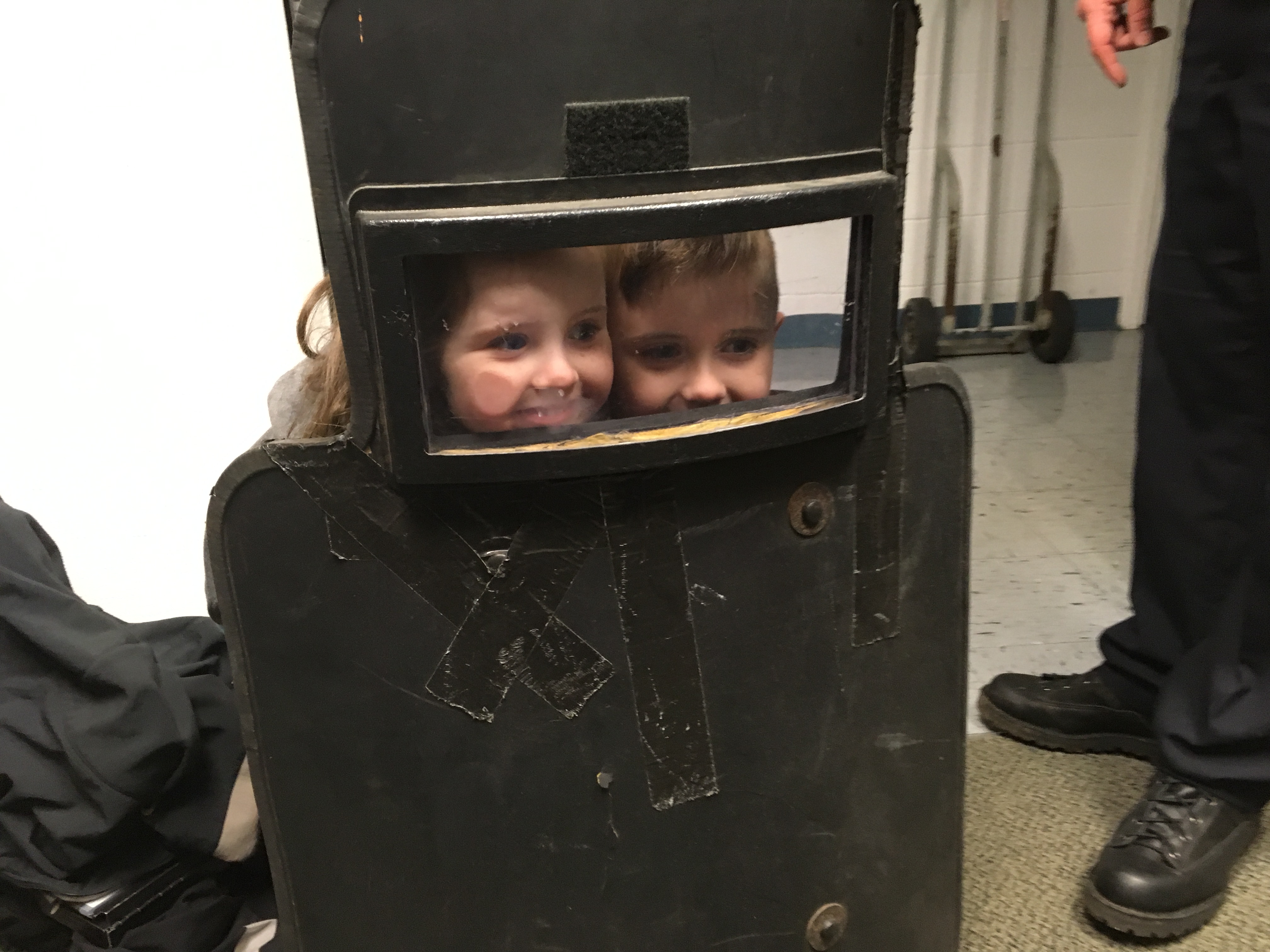
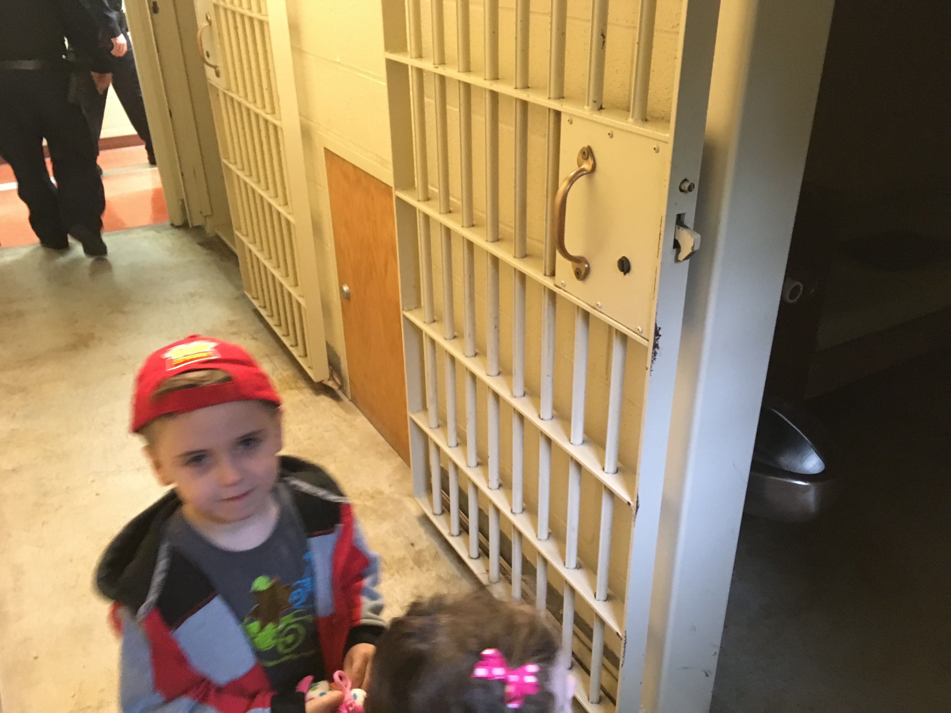
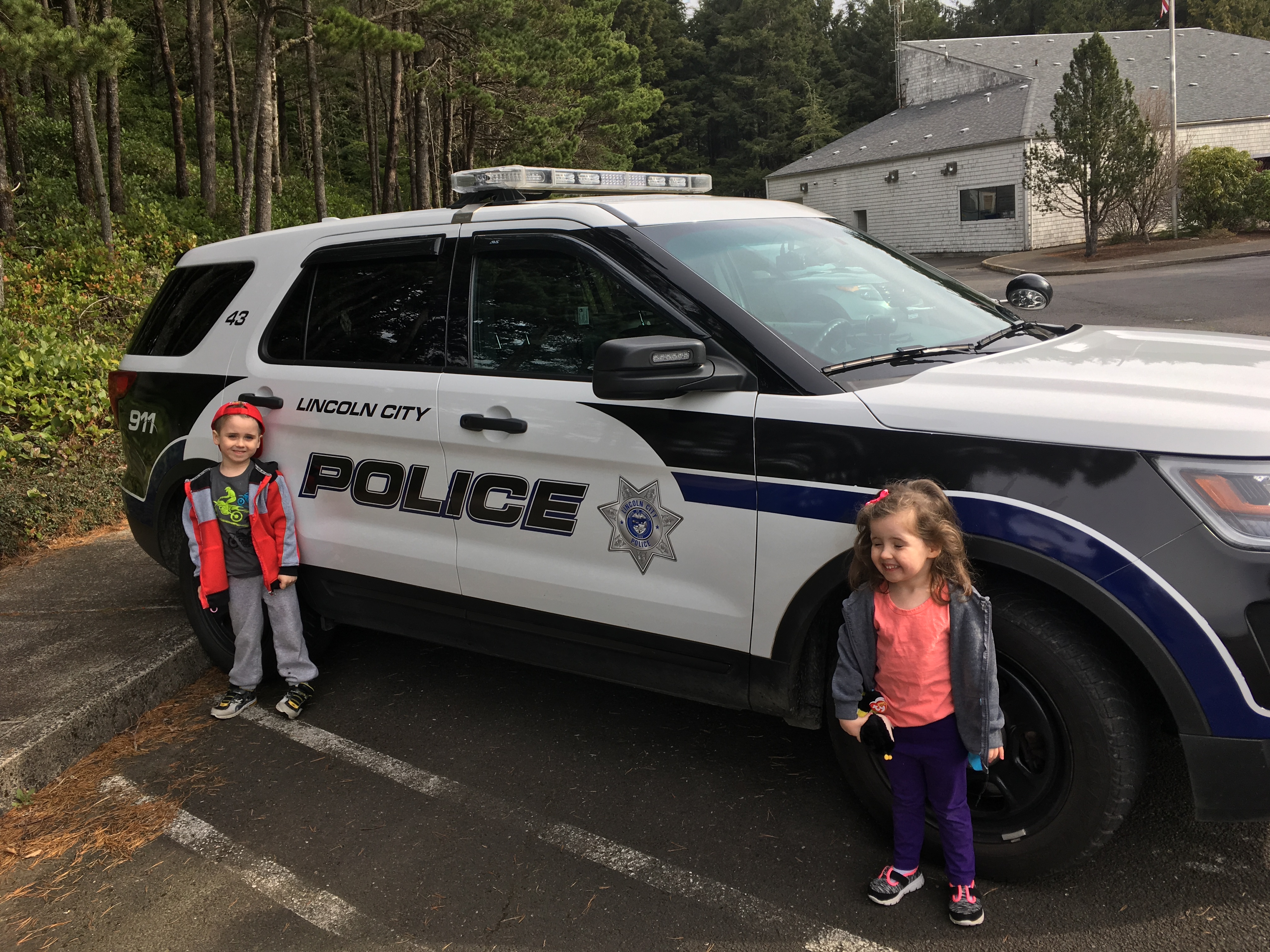
Children say the darndest things sometimes, and when they said “where do the police live?” a chuckle escaped me. “The police station,” I replied. After a moment of silence, I heard from the backseat: “can we see where the police live?”
We visited our local police station and were welcomed by Officers Greg Hirch and Cody Snidow, who gave us a private tour. My kids, Alaina and Skyler, ages three and four, were in heaven. They toured the jail cells and really enjoyed seeing the breathalyzer machine. I think they understand not to drink and drive now.
Next stop was the evidence room where they made a friend with Molly, who wouldn’t let them in, not even with their Junior Police Officer sticker badges. The officers said that they didn’t get to go in there either, so the kids didn’t take it personally. Molly explained how the evidence process works and told the kids about her own little girl.
The kids received official Lincoln City Police wristbands from a pair of detectives, who seemed to enjoy the distraction as they smiled and watched the kids exploring their office.
The kids got to see the garage where police cars pull in and offload bad guys. Officer Hirch said they “close the door so they can’t get away.” The kids liked Officer Hirch very much because he explained everything the entire time.
Officer Snidow told us he had a young boy the same age as mine, and had a smile on his face as the kids inspected a police car outside. He seemed to be genuinely enjoying this impromptu visit. Cody Snidow is brand new to the force having been sworn in just two days ago. Our conversation was interrupted by lights and siren, to which the kids froze with shocked looks, turning into big smiles as they ran around the car pretending to be mini-police officers.
It was an amazing unplanned visit that was both educational and fun. Most kids pine for the zoo. My kids yearn to visit a police station. They certainly found the trip an arresting one!
The budget for the new Lincoln City Police Department headquarters was recently approved by the city council, and is still in the planning phase. Construction should start in the fall.
Outgoing Police Chief Keith Kilian is retiring on April 5th. A retirement celebration will be held at 4 p.m. on April 5th in the Lincoln City Council Chambers at City Hall.
UPDATE: Adam Wagner and Gabe Smith fined $195 each by City of Lincoln City for violating special events permit law.
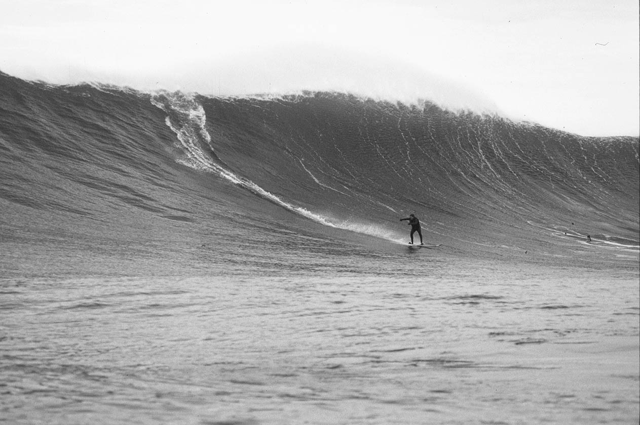
John Forse surfs Nelscott Reef
Lincoln City, Oregon – John Forse, founder and organizer of the Nelscott Reef Big Wave Classic, issued a press release today announcing the closing of its 13th season. Forse, a native of Lincoln City, said the event didn’t run this year due to interference by an unpermitted outside group, who used a strikingly similar name, and website, thereby confusing sponsors into giving money to the rogue group.
“There are people getting rolled over by this log. had I not made it up the hill I would have died.” – Headstand Photography’s Jon Monroe
On November 29, 2017, a contestable swell was forecasted and a group calling themselves the similar sounding Nelscott Reef Big Wave Pro-Am, had surfers in the water, according to Forse. In Dec. 2017, we reported that tourists were almost crushed by a huge rolling log in the surf because no safety monitors were established. Our publisher, Justin Werner, testified at the December 11, 2017 City Council meeting about the safety concerns surrounding the group’s unsanctioned activities:
Following the meeting, Forse appeared before the council four more times and pleaded with the city to cite the unlicensed operators. After the fourth meeting, City Manager Ron Chandler told Forse the City found the rogue event organizers in violation.
Organizers of the bootleg event were then cited by Lincoln City Police Chief Keith Kilian for failure to obtain the proper permits and licenses. Gabe Smith and Adam Wagner, both from Portland, are required to appear in Lincoln City Municipal Court on April 12th at 9:00am. Failure to appear is a Class A misdemeanor, punishable by a year in jail, and a $6,250 fine.
Numerous local businesses unwittingly gave money to Smith and Wagner, who told them they would be featured on banners and in a live webcast for a contest that never materialized. These businesses included 10 Barrel Brewing Co., Inn at Lincoln City, Roby’s Furniture and Appliance, Oregon Coast Bank, The Coho, Coldwell Banker, JKI Realty, D Sands Motel, Meredith Lodging, Dive N’ Surf, Salmon River Contractors, Olivia Beach, A Vista d’ Mar, Yaquina Cab, Naked Winery, Anchor Storage, Zuhg Surf Shop, Henkels Law, and many others. They are welcome to attend the court hearing to voice their concerns and demand their money be returned.
Fortunately, the Nelscott Reef Big Wave Classic will return next fall for the 14th annual event with a $10,000 purse and webcast. For more event info visit: https://nelscottreef.com.
The Nelscott Reef Big Wave Classic is a one day event that is held between October and March. The event is called on three days notice of optimal conditions. Surfers come to Lincoln City from around the world to ride the biggest wave on the Oregon Coast: our own Nelscott Reef.