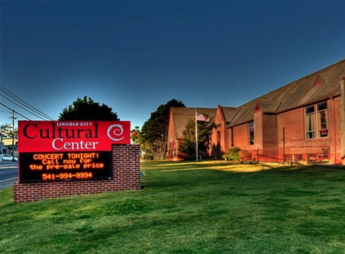
Lincoln City Cultural Center Calendar of Events
This calendar was updated Aug. 28, 2017
Schedule of Events, September-December 2017
For information, contact Niki Price, [email protected] or 541-994-9994 (unless otherwise noted)
Lincoln City Cultural Center & Visitor Info Center
The info center is open to the public, staffed by employees and volunteers, every day except for Tuesday. The center is now on summer hours, open from 10 am to 4 pm, Wednesday-Monday (including most Monday holidays). To reach the info center, call 541-994-3302. For all ticket and event inquiries, call 541-994-9994.
How to Purchase Tickets
Tickets may be purchased anytime on our website www.lincolncity-culturalcenter.com. Click the large “Buy Tickets Online” button on the left side of the screen. Tickets may also be purchased by calling our business office, 541-994-9994, or in person at the Visitor Information Center, open Wednesday-Monday from 10 to 5 in the summer (Memorial Day to Labor Day) and 10 am to 4 pm the rest of the year. LCCC Members always receive $2 off LCCC event ticket prices with your member code. For membership information call 541 994-9994 or see our website.
SEPTEMBER 2017
SUNDAYS from 9 am to 3 pm Lincoln City Farmers and Crafters Market
Shop for produce and nursery starts, along with locally made arts, crafts, packaged foods and more. Open every Sunday, May through mid-October. For details, call 541-921-0062.
Through Sept. 4 Loving, Studying & Restoring Our Public Open Spaces with Nora Sherwood
Thanks to the foresight and grit of Lincoln City’s powers-that-be, the City is fortunate to include 370 acres of open space within its boundaries; 28 areas with an amazing treasury of flora and fauna preserved to benefit us all. This Chessman Gallery exhibit will explore the open spaces from a natural science illustrator’s perspective, with renderings that highlight important species, projects, and restorations that are currently taking place. On display during LCCC hours, 10-4 Wednesday-Monday, through Sept. 4.
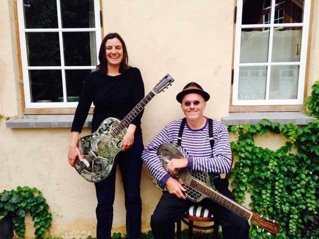
Sunday, Sept. 3 LCCC Presents: Ruaile Buaile, 7 pm
A four-piece modern-day trad/Pop/Folk group from Offaly, in the heart of Ireland, Ruaile Buaile has played festivals from Germany to Holland and from the United Arab Emirates to the United States of America. Friends Niall (vocals and guitar), Arthur (fiddle and banjo), Shane (vocals and bass) and Jack (Cajun and banjo) perform with high-energy, ground-thumping Celtic beats with a little Irish charm and flair. Tickets are $20 adv/$22 door/$2 for LCCC Members.
Friday, Sept. 8 Reception: Children’s Book Illustration Show
This exhibit will include framed, original illustrations as well as prints and finished books by author/illustrator Sarah Gayle, graphic novelist and children’s author Matt Fitzwater, and local muralist Krista Eddy, who has a new, experimental black and white book. The opening reception is set for 5-7 pm on Friday, Sept. 8, with the exhibit on display through Oct 9.
Saturday, Sept. 9 & Sunday Sept. 10 A Celebration of Books & Authors with Oceana Family Literacy
Oceana Family Literacy and the LCCC invite you to celebrate International Literacy Day with two days of family fun! For more information, call Oceana director Vickie Meneses at 541-921-1865. Here’s the schedule of events:
- The International Literacy Day festival will be held in the auditorium, Margaret’s Meeting Room and Elizabethan Room (and the hallways) from 9 am to 4 pm on Saturday, Sept. 9. Enjoy author readings, storytelling, music and food, as well as the children’s book illustration exhibit in the Chessman Gallery and an author fair in the auditorium. Admission is free, with author table proceeds benefitting Oceana Family Literacy.
- On Saturday evening, local actress Patti Siberz will perform her one-woman play, “The Bookshop.” This play tells the story of Rose, who has worked in the same shop for the past 50 years. On the last day, for both Rose and the business, she reminisces about the customers she has met and the books she has loved. Siberz wrote “The Bookshop” as her senior project, when she earned her degree from Linfield College, and drew from her experiences in the Lincoln City book business. The performance will begin with a classical music interlude by violinist Kathy Follett and cellist Walt Hoggset, playing selections from Mozart, Grieg and Handel. The play will begin at 7 pm, and tickets are $10 (available at the door, or in advance at lincolncityculturalcenter.org).
- On Sunday, Sept. 10, there will be a “Chair-ity” Silent Auction, with decorated rocking chairs of all shapes and sizes, as well as baskets with everything from wine and books to violin lessons and art instruction. Come for the Farmers Market, and drop by to bid – all proceeds go to Oceana. Open starting at 9 am.
- Also on Sunday, Sept. 10, the LCCC will host “Sunday Stories” with The Mountain Man – aka Doug Force. Doug will be telling American folk tales, Grimms fairy tale, Aesop’s fables and more, with complimentary refreshments. This LCCC event is by donation, and begins at 2 pm.
Sunday, Sept. 10 Sunday Stories with Doug Force, 2 pm
Residents and visitors, kids and adults, historians and story lovers of all ages: you’re invited to enjoy this free Sunday Stories program featuring professional storyteller Doug Force. The LCCC offers complimentary cookies, along with Doug’s animated tales. This Sunday, he’ll be telling American folktales, Grimm’s fairy tales and Aesop’s fables, at 2 pm in Margaret’s Meeting Room. Combine it with a visit to the Sunday Farmers Market, open 9 to 3 pm every Sunday May-October.
Thursday, Sept. 14 Tunes in the Dunes Ukulele Concert & Benefit, 7 pm
Some of the best ukulele players in the world are coming to Lincoln City for the seventh annual Tunes in the Dunes retreat at Westwind camp. Before the workshop begins, however, they’ll be playing a benefit concert at the Lincoln City Cultural Center! Enjoy a cabaret style performance with luminaries like Steven Espaniola, Aaron & Nicole Keim, Jim D’Ville, Bryan Holley, James Hill & Anne Janelle, Andy Andrews and the Hood River Trio. Bring your own ukuleles and voices for the sing-a-longs, before and after the concert. It’s an evening of joyful ukulele music, with all proceeds going to the Westwind Stewardship Group. Tickets are $20 (LCCC Membership discount does NOT apply).
Saturday, Sept. 16 Big Band Dance with the Lincoln Pops, 7 pm
Three sets of great Big Band music from the Lincoln Pops Orchestra, 25 musicians who really know how to swing (and foxtrot, waltz, polka, tango….). Bring your dancing shoes or just tap those toes. No-host bar with beer, wine, sodas and sweet treats. Tickets are $12 adv/$13 at the door/LCCC membership discount applies.
Sunday, Sept. 17 Coffee Concert, 4 pm
Enjoy a casual matinee concert with local musicians, complimentary pastries and yummy Cape Foulweather Coffee. Admission by donation with all proceeds going to the LCCC. Want to perform in a future Coffee Concert? Call Rita at 541-994-8585.
Thursday, Sept. 21 LCCC Presents: 100 Years of Recorded Jazz with the Cherry Blossom Orchestra, 7 pm
This year, we’re marking the 100-year anniversary of the earliest jazz recordings by the Original Dixieland Jazz Band from New Orleans. Celebrate and savor the sounds of vintage jazz and blues with the Cherry Blossom Orchestra, a seven-piece band based out of Portland and led by Richard Basi. Tickets $20 adv/$22 door/$2 off for LCCC members.
Sunday, Sept. 24 LCCC Presents: Sofia Talvik, 7 pm
The LCCC’s New Folk series will begin with Sofia Talvik, a singer/songwriter playing Americana with Swedish roots. She’s a North Sea siren, blending sparkle and melancholy as she creates her own special niche, guitar and voice. Since she first began touring the US more than 10 years ago, Talvik has released six full-length albums and a number of EPs, as well. Tickets are $20 adv/$22 door/$2 off of current members of the LCCC.
Wednesday, Sept. 27 Volunteer Fair & Theatre West Volunteer Welcome
Or just browse the Volunteer Fair, open from 10 am to 4 pm in the LCCC hallway. Local organizations will be staffing tables, offering opportunities for you to give back. To learn more or register your nonprofit, call organizer Donna Morris at 503-703-8224. Later today, we’ll be hosting a joint party for the volunteers from Theatre West and the LCCC, as we prepare for the opening of “Calendar Girls” on Oct. 19.
Saturday, Sept. 30 Relay for Life, 10 am to 10 pm
The LCCC is proud to serve as a partner in this year’s Relay for Life, our community’s annual fundraising fight against cancer. Teams will be making laps around the LCCC grounds, hearing live music and inspirational messages, for 12 hours (10 am to 10 pm). Organizers are planning vendors, team booths, bands, food and more. To register your team or learn more, head to www.lincolncityrelay.org.
Lincoln City Cultural Center Calendar of Events
OCTOBER 2017
Sundays – Oct. 1, 8, 22 and 29 from 9 am to 3 pm Lincoln City Farmers and Crafters Market
Shop for produce and nursery starts, along with locally made arts, crafts, packaged foods and more. Open outdoors every Sunday, May through mid-October. Starting on Oct. 22, the market will be indoors for the rest of the calendar year. For details, call 541-921-0062.
Sunday, Oct. 8 Coffee Concert, 4 pm
Enjoy a casual matinee concert with local musicians, complimentary pastries and yummy Cape Foulweather Coffee. Admission by donation with all proceeds going to the LCCC. Want to perform in a future Coffee Concert? Call Rita at 541-994-8585.
Tuesday, Oct. 10 LCCC Presents: Sound of Nature, Sound of Art IV
The LCCC is proud to present this fourth annual collaboration of art, music and ecology, a celebration of Cascade Head Scenic Research Area and the rare natural beauty of the Oregon Coast. This year’s featured ensemble will be the Three Centuries Ensemble, the performing works inspired by nature. The music, in turn, will inspire invited artists, who will respond to both the beauty of Cascade Head and the music itself, while the audience looks on. Co-sponsored by the Studios to Schools project, U.S. Bank, the Local 99 AF of M and the members of the Lincoln City Cultural Center. EARLY BIRD TICKETS ($15 each) go on sale Sept. 1. After Oct. 1, tickets are $22, $24 at the door. Public concert begins at 7 pm, doors open at 6:30 pm.
Friday, Oct. 13 Chessman Gallery Reception: Portals Into Fiber
This fiber arts group show will focus on both message and aesthetic, using fiber as a portal to understanding a range of human emotions. The opening reception is set for 5-7 pm on Friday, Sept. 13, in the P.J. Chessman Gallery, with the exhibit on display through Nov. 6.
Friday, Oct. 13 Wandering Reel Traveling Film Festival, 7 pm
Join Michael Harrington, curator of the Wandering Reel Film Festival, for an evening of short international films on the theme “You. Me. We.” Featured titles will include “Mare Nostrum,” about Syrian refugees on the Mediterranean coast, and “Artalde,” a Basque film about a shepherd lost in the city, along with other films from Iran, Canada and France. For details, head to www.wanderingreel.org.
Saturday, Oct. 14 Harvest Gold: A Tribute to Neil Young, 6-8 pm
Neil Young interpreter Richie Bean is joined by Chris Ochsner, Monte Allen and Eric Jerde, as they take a journey through the Young’s remarkable career. Tickets, $12 in advance and $15 at the door, will go on sale Sept. 14 on the LCCC’s website, www.lincolncityculturalcenter.org. Sorry, LCCC member discounts do not apply.
Thursday, Friday & Saturday, Oct. 19, 20 & 21 Theatre West: “Calendar Girls”
When Annie’s husband dies of leukemia, she and her best friend Chris resolve to raise money for a new settee in the hospital waiting room. They manage to persuade four fellow members of the WI to pose nude with them for an “alternative” calendar, with a little help from hospital porter and amateur photographer Lawrence. The news of the women’s charitable venture spreads like wildfire, and hordes of press descend upon the small village of Knapely in the Yorkshire Dales. The calendar is a success, but Chris and Annie’s friendship is put to the test under the strain of their newfound fame. “Calendar Girls,” by Tim Firth, is based on a true story. Playing in the LCCC auditorium at 7 pm Thursdays, Fridays and Saturdays, Oct. 19-Nov. 10. Tickets are $15 for adults, $13 for seniors and students, $10 for youth ages 12 and younger.
Friday-Sunday, Oct. 20-22 Bus Meet Up for “A Tour to Die For”
The award-winning program, A Tour To Die For, brings Lincoln City history to life. Your ticket includes refreshments at the LCCC, followed by a guided bus tour that ends at the Taft Pioneer Cemetery. There, you’ll take a lantern tour and meet six of the people interred there, played by local actors. It’s a benefit for the cemetery, the North Lincoln County Historical Museum and Theatre West, sponsored by the City of Lincoln City. Tours begin at 5:30, 6:00, 6:30, 7:00, 7:30 and 8:00 pm on Friday and Saturday nights, and at 2:00, 2:30, 3:00, 3:30, 4:00 and 4:30 pm on Sunday. Tickets not sold at the LCCC, but through the event website: www.tourtodiefor.com.
Wednesday, Oct. 25 LCCC Presents: Jamie Stillway and Ben Bonham, 7 pm
Jamie Stillway and Ben Bonham are setting out on their “mostly annual” fall tour, and will be stopping in Lincoln City for a performance at the Lincoln City Cultural Center on Wednesday, October 25th. Their eponymous debut release snagged serious accolades from all corners, and was named one of the top albums of the year by Willamette Week. “Stillway and Bonham cut through the clatter of pop music with a package that’s part Django Reinhardt and part Rev. Gary Davis, tied up with a ragtime bow. Jamie Stillway not only comps big, fat, swinging and expensive jazz chords but picks with a ferocity that would make Django proud, and her technique is commanding and artful. Ben Bonham devilishly evokes front-porch picking sessions and Hawaiian luaus with his liquid strokes but can cop a nasty swing on demand–both guitarists are supremely accomplished” –Don Campbell, The Oregonian. Tickets are $18 adv/$20 door.
Thursday, Friday & Saturday, Oct. 26, 27 & 28 Theatre West: “Calendar Girls”
See description above.
Friday-Sunday, Oct. 27-29 Bus Meet Up for “A Tour to Die For”
See Oct. 20-22, above.
NOVEMBER 2017
Sundays – Nov. 5, 12, 19 and 26 Lincoln City Farmers and Crafters Market
Shop for produce and nursery starts, along with locally made arts, crafts, packaged foods and more, indoors in the auditorium and hallways from 10 am to 3 pm. For details, call 541-921-0062.
Thursday, Friday & Saturday, Nov. 2, 3 & 4 Theatre West: “Calendar Girls”
And Thursday, Friday & Saturday, Nov. 9, 10 & 11
See description above.
Friday, Nov. 3 Reception for author Ron Lovell, 5-7 pm
Join us for a reading and discussion with author Ron Lovell, whose most recent book is “A Dangerous Assignment.” Lovell is a former journalist and professor at Oregon State University, who is best known for his Thomas Martindale Mystery Series (most of the 10 books are set on the Oregon Coast). “A Dangerous Assignment” is the second installment in Lovell’s Lorenzo Madrid series. Enjoy a glass of wine, and get your copy signed at this collegial reception.
Friday, Nov. 10 Chessman Gallery Reception: A Colorful Confluence
A collaborative show featuring two artists: Carol Pulvermacher and Virginia Leonnig. These two Oregon artists express a shared love of Pacific Northwest wildlife using different mediums and styles. The opening reception is set for 5-7 pm on Friday, Nov. 10, with the exhibit on display through Dec. 4.
Friday, Nov. 17 Hospice Light Up a Life, 6 pm
This remembrance event, held by the hospice programs of Samaritan Health Services, honors the individuals who have passed on. Events involve reflections by hospice staff, music and a ceremony in which the names of the individuals being honored and remembered are read. Honorees need not have been under the care of hospice. For more information or to make a donation by phone, please call 1-844-768-4256. To donate online, please choose North Lincoln Hospital Foundation below and choose “Hospice” under the designation drop down menu.
Saturday, Nov. 18 LCCC Presents: XX Digitus Piano Duo, 7 pm
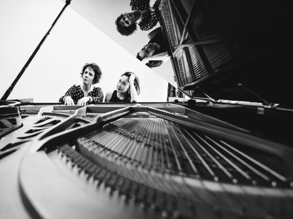
Selected by Artslandia magazine as one of their top 50 favorite artists, pianists Maria Garcia and Momoko Muramatsu have had successful individual careers that have taken them around the world and to festivals like the Aspen, Tanglewood, Bergen and Casals festivals, as well as performing with groups like the Mark Morris Dance Group amongst others. Friends and colleagues since college years at the New England Conservatory, since 2014 they have joined forces to explore the two piano and one piano-four hand repertoire creating the XX Digitus Duo (“Twenty Fingers”). Hailed by the press as “Dynamite”, “Intrepid” and “Impressive” they explore the classical standards but also the vast repertoire of their shared Latin American musical heritage, and are deeply committed to working with composers in creating new works for the medium commissioning four works in the past two years from composers Ken Selden, Dag Gabrielsen and Charles Copeland. Their goal is to create exciting musical experiences that include classical/contemporary/rock audiences with an eclectic choice of repertoire while collaborating with other art forms such as film, visual arts, poetry and dance. Tickets $20 adv/$22 door/LCCC membership discount applies. Lincoln City Cultural Center Calendar of Events 2017.
Friday & Saturday, Nov. 24 & 25 Tree Lighting Party and Santa Sale
Launch your holidays at the Lincoln City Cultural Center, where we have live music, handmade gifts and a make-and-take ornament workshop, leading up to the lighting of Lincoln City’s Christmas tree, at dusk. Visits with Santa, group carols and a whole lot more, through Saturday at 5 pm. For details, call the LCCC office at 541-994-9994.
Tuesday, Nov. 28 Giving Tuesday Generosity Bazaar
There’s Black Friday for shopping, Cyber Monday for browsing… and Giving Tuesday for feeling the true spirit of the season. The LCCC will make your seasonal giving easy, with representatives from Family Promise, Lincoln City Homeless Solutions, and more, all gathered in one place with information, ideas and donation receipts galore. You can even buy your aromatic Rotary wreath, and go home with a smile. To learn more (or volunteer) call Niki at 541-994-9994. Time TBA.
DECEMBER 2017
Sundays – Dec. 3, 10, 17 & 24 Lincoln City Farmers and Crafters Market
Shop for produce and nursery starts, along with locally made arts, crafts, packaged foods and more, indoors in the auditorium and hallways from 10 am to 3 pm. For details, call 541-921-0062.
Saturday, Dec. 2 LCCC Presents: Nora Jane Struthers and the Party Line, 7 pm
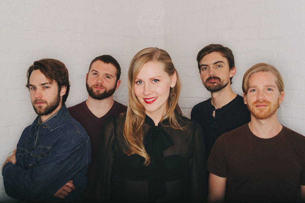
Hooray and hearty welcome to Nora Jane Struthers, a Nashville-based singer and songwriter who is known for her Americana and roots rock. Struthers’ 2013 album Carnival, recorded with her touring band The Party Line, spent more than three months in the Top 20 of Americana Radio charts and peaked at No. 7. Carnival ranked 24th on the 2013 Americana Airplay Top 100 list.[6] In a review of Carnival, the Tampa Bay Times wrote that Struthers’ unique brand of “rich storytelling, repeat-worth melodies and a modern mashup of traditional, bluegrass folk, country and rock influences” sets her apart from many roots-inspired contemporaries. $20 adv/$22 door/$2 discount for current LCCC members.
Sunday, Dec. 3 Help Portrait Oregon Coast 2017
They don’t want to take your portrait, they want to give it to you. For free! The Yaquina Art Association Photographer’s Club offers this annual holiday gift, so bring your family, your spouse, your grandkids (even your well-behaved pet) and take a number. Sit for a portrait, then receive a high-quality 5 x 7 or 8 x 10 print, compliments of these volunteers. 11 am to 5 pm in Margaret’s Meeting Room, helpportraitoregon.com.
Wednesday, Dec. 6 LCCC Presents: Halie for the Holidays

Let Halie Loren’s warm voice and gentle phrasing usher in your holiday season. Halie is based in Eugene, and is a local favorite here on the coast, but her trio is welcomed in jazz clubs all over the world. Authenticity and connection is one of the primary keys to Loren’s artistic approach: whether it’s injecting the American Songbook with old-school soul or finding a familiar thread of nostalgia in newly-penned originals, no matter the language (her repertoire finds her singing in French, Spanish, Portuguese, Italian, and more), Loren finds ways to bridge cultures and genres in unlikely and always heart-felt ways. “Music creates greater connection with other people, connection to my purpose for existence,” Loren says. Tickets are $22 in advance, $24 at the door.
Friday, Dec. 8 Chessman Gallery Reception for Chiaroscuro: Casting Shadows in Mosaic
The ancient art of mosaic is enjoying a renaissance in the world today. This group of artists from Oregon and Washington all work in the broad medium of mosaic, and will explore the nature of light and dark, how shadows are cast by materials, and how mosaic materials reflect or absorb light. Participating artists will include Lynn Adamo, Joanne Daschel, Scott Fitzwater, Jennifer Kuhns, Karen Rycheck and Mark Brody.
The opening reception is set for 5-7 pm on Friday, Sept. Dec. 8, with the exhibit on display through Jan. 9, 2018.
Saturday, Dec. 16 LCCC Presents: Na Rosai
Na Rósaí is a Portland-based band playing a mix of traditional Irish music, old time Appalachian tunes, and a set of Breton, and French tunes. It features Preston Howard [Uilleann Pipes, Whistles], Richie Rosencrans [Bouzouki, Tenor Guitar, Vocals], Conor O’Bryan [Flute] and Erik Killops [Fiddle]. Tickets are $20 adv/$22 at the door/$2 discount for current LCCC members. Showtime 7 pm. Tickets $20 adv/$22 door/$2 off for LCCC members.
Sunday, Dec. 24 Christmas Eve Concert with the First Baptist Church
Details TBA
Sunday, Dec. 31 New Year’s Eve Bash with the Lincoln Pops Orchestra
Ring in the new and (hopefully) improved 2018, with the Lincoln Pops Orchestra and the Lincoln City Cultural Center. The Pops, a 25-member band that specializes in Big Band classics, Latin dance orchestrations and other feel-good tunes, will be playing from 8:30 to midnight Saturday, Dec. 31. Tickets include light appetizers, four sets of live music, light appetizers and a midnight toast of champagne or sparkling cider. Advance tickets are $45 per person, or $80 for two.
CLASS SCHEDULE (look for more information and updates on our website; Lincolncity-culturalcenter.org/classes)
TAI CHI – Saturdays Sept. 30-Dec. 16, 1-2 pm
Anyone can improve their balance, stamina, muscle tone and general health through Tai Chi. The class, taught by Laurel Pollock, is based on the program “Tai Chi for Better Balance,” for adults ages 21 and older. To register for this class, offered through Oregon Coast Community College, call 541-996-6222 or head to oregoncoastcc.org/communityed.
BALLET & MODERN DANCE FOR ADULTS – Tuesdays Oct. 31-Dec. 12 at 10 am
This beginner level class, taught by Nicole O’Brien, fuses ballet and modern dance techniques. Using healthy alignment, students will learn the traditions of a ballet barre, floor work in the modern style and exercises to tone and improve flexibility. To register for this class, offered through Oregon Coast Community College, call 541-996-6222 or head to oregoncoastcc.org/communityed.
BEGINNING BALLET FOR YOUTH –SATURDAYS
Diane Christiansen’s classes are on hiatus for the summer, but will return on Saturdays in the fall. For details, contact Diane at 507-420-5363.
IRISH DANCE – MONDAYS
Nora Sherwood leads this Irish dance class, with soft-shoe step, ceili and sean-nos (and don’t worry if you don’t know exactly what those are – here’s where you can find out!). Nora is a retired Irish dance champ and musician who enjoys sharing her love of the dance and the music that accompanies it. To register or learn more, call her at 541-283-5949 or e-mail [email protected].
NEW MOON YOGA
New Moon is a collective run by volunteers with a goal to make the benefits of yoga available to anyone. Daily classes vary from morning to afternoon and evening and tend to be fluid. There are classes for all levels of experience and range from 1 hour to 75 minutes. For the latest schedule, prices and special punch card promotions, log into www.NewMoonYoga.org. For more information or to get on the daily class reminder e-mail list contact [email protected]
ZUMBA with Tina – Wednesdays and Mondays at 5:30
Ditch the workout, and join the party. No dance experience required! Salsa * Merengue * Reggaeton * Bellydancing * Tango * Samba * Cumbia * Bachata *FUN * TONING * WEIGHTLOSS. To learn more, contact Tina Marshall, 541-921-8353, [email protected] or FB “Zumba With Tina.” Drop-ins welcome, and punch cards are available.
ENCOURAGING HEALTHY WEIGHS – MONDAYS 5:15 to 6 pm
This group meets every Monday, to lose weight and be healthy in a fun and caring way. Weigh-in set for 5 pm, class from 5:30 to 6:15 pm. Open to anyone struggling with weight issues. No pressure! No stress! Just encouragement. Cost: $5 per month. Drop-ins welcome. For more info or to pre-register, call Tracy at 541-764-2510 or Elizabeth at 541-994-6902.
LCCC CERAMICS STUDIO – Kimberly Ota operates the Lincoln City Clay Studio, in the lower level (Studio 3) of the LCCC, which has ceramics workstations, rollers, wheels and kilns. Adult Clay Night with Open Studio is held on Tuesdays from 6-8:30 pm, $90 plus materials for an eight-week session. Open studio time, private instruction and special events are available. To register or learn more, call Ota at 510-435-4832 or write to [email protected].
LCCC TEXTILE CENTER – Operated by volunteers Lyle and Arlene Gowing, and featuring a wide variety of looms, wheels, yarns and books; four floor looms, two rigid heddle looms, six spinning wheels, two tapestry looms, two quilt frames, lots of yarn for your projects, sold by donation to the cultural center. For a donation of $25 to the LCCC, the Gowings will give you an introductory lesson in spinning or weaving. Make an appointment for a class, or drop by during the following hours:
Monday, Tuesday &, Saturday by appointment
Wednesday 1 – 8 pm; use SE Basement Door when Center is closed
Thursday & Friday 11 am – 3 pm
Sunday During the Sunday Farmers & Crafters Market
SPINNING & WEAVING — For a donation of $25 to the LCCC, the Gowings will give you an introductory lesson in spinning or weaving, at a time of mutual agreement. To learn more, call them at 541-921-5150.
LOOM RENTAL — Looms are available for rent, $5 an hour or $80 a month.
FARTS (Fiber Arts, Radical Teachers and Students) – A Fiber Fellowship of artists who meet every Wednesday from 6-8 pm at the Textiles Studio
MOSAIC WORKSHOP – Joanne Daschel teaches classes, creates fine art mosaic landscapes and makes popular custom address signs. She also leads mosaic mentoring and project-based classes, by reservation. To learn more, contact her at 541-992-0906 or email [email protected]
Lincoln City Cultural Center Calendar of Events