Students will be out of school for winter break soon and you may be asking yourself: “Where is my kid going to go?”. Depoe Bay’s Kidzone should be a blast. Check that out. 

Students will be out of school for winter break soon and you may be asking yourself: “Where is my kid going to go?”. Depoe Bay’s Kidzone should be a blast. Check that out.
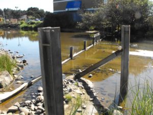 It is now deemed an ordinary occurrence when rain causes raw sewage to spill onto public beaches. Public works stated the last time a few months back they spent millions to fix the issue yet this November/December another nasty spill took place. The city needs to be held accountable for these spills. Devils Lake is always being used by the city to dump raw sewage also. Wake up and smell the scat. Dump the city manager and his legal hack. Facebook… Friends of Devils Lake… come check it out.
Richard Danielson
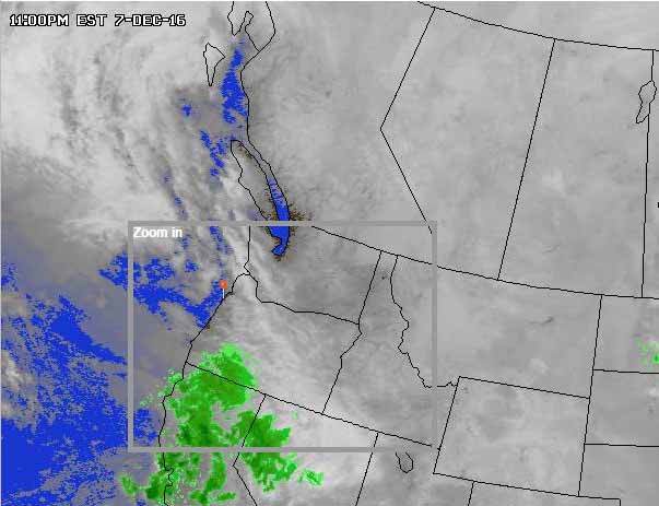 WED DEC 7 2016 …WINTER WEATHER ADVISORY IN EFFECT FROM 4 AM TO 1 PM PST
THURSDAY FOR THE CENTRAL OREGON COAST…
THE NATIONAL WEATHER SERVICE IN PORTLAND HAS ISSUED A WINTER
WEATHER ADVISORY…WHICH IS IN EFFECT FROM 4 AM TO 1 PM PST
THURSDAY FOR THE CENTRAL OREGON COAST…
INCLUDING THE CITIES OF…LINCOLN CITY…NEWPORT…FLORENCE
* TIMING…FREEZING RAIN…POSSIBLY MIXED INITIALLY FOR A SHORT
TIME WITH SLEET OR A LITTLE SNOW…BEGINNING A LITTLE BEFORE
SUNRISE THEN CONTINUING AS MOSTLY FREEZING RAIN INTO THE EARLY
AFTERNOON. PRECIPITATION SHOULD MAINLY BE RAIN AROUND OR JUST
AFTER NOON ON THURSDAY.
* SNOW ACCUMULATIONS…FROM A TRACE TO LESS THAN AN INCH.
* ICE ACCUMULATIONS…UP TO ONE OR TWO TENTHS OF AN INCH OF ICE.
* IMPACTS…TRAVEL WILL BE DIFFICULT AT TIMES AS ROADS BECOME ICY.
PRECAUTIONARY/PREPAREDNESS ACTIONS…
A WINTER WEATHER ADVISORY MEANS THAT PERIODS OF SNOW, SLEET, OR
FREEZING RAIN WILL CAUSE TRAVEL DIFFICULTIES. BE PREPARED FOR
SLIPPERY ROADS AND LIMITED VISIBILITIES, AND USE CAUTION WHILE
DRIVING.
 The Traveling Tigers Student Travel Club will be hosting an arts and crafts fair on December 3rd at Taft’s Meeting Hall from 10:00am – 5:00pm.
Vendors will range from handmade cards, fine art sculptures, locally sourced canned goods, Lula Roe clothing, and much more!
Wrapping station will be available!
Cake Walk and Raffle happening at 4:00PM.
If you have any questions, or would like to buy a booth, contact Sam at [email protected]
Let them know if you are interested or are going, on Facebook.

FACEBOOK POST —- Hannah Lamb
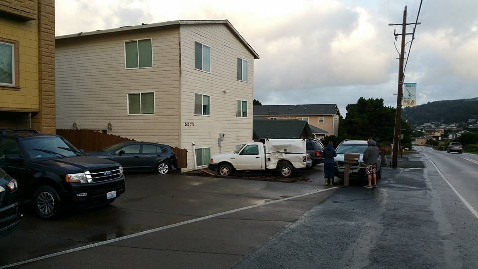
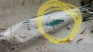
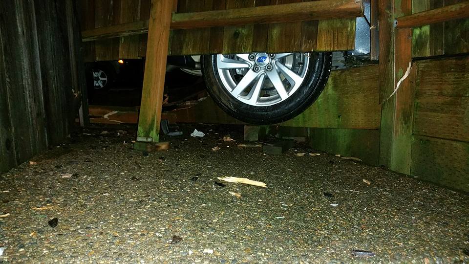
**HIT AND RUN ON ROADS END** At 5:40am this morning we awoke to a loud crash. Looked outside and saw a car speeding away. They must’ve been coming down the hill on Logan Road too fast, lost control and hit a car next door, sending it through the fence just missing our house and gas meter! The car that did this smashed into the white truck sending it into the car next to it and then left burnt rubber from getting stuck before speeding off (shown in the photos) The car that did this has to have some serious damage and is a teal/turquoise/aquamarine color. The cops came and took photos this morning and said a car was seen speeding south of town with damage but has yet to be located. Please share this and hopefully we can find the person and they can be held accountable.
Lincoln City Police are still searching for the suspect vehicle. Possibly a Honda, BMW, or Mercedes as the color is unique to those vehicles and witnesses described a small car.
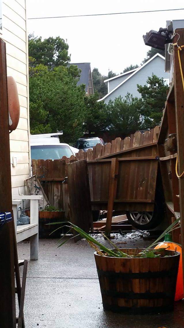 Hannah Lamb also said this could have been much worse as the vehicle in this image came within six feet of hitting their gas meter which is right next to a large boiler/water heater.
If you see any turquoise/teal/aquamarine vehicles with damage please contact the Lincoln City police Department at (541) 994-3636
“The truck and other car in our driveway belong to our neighbors. If the e-brake hadn’t been on in the truck, all the cars would’ve been damaged and I don’t think the person would’ve got away. So crazy how quickly things can change.” – Hannah Lamb
Two earthquakes were monitored by The United States Geological Survey late Sunday and early Monday about 100 miles west of Bandon, OR.
The earthquakes were measured at 4.8 and 4.9.
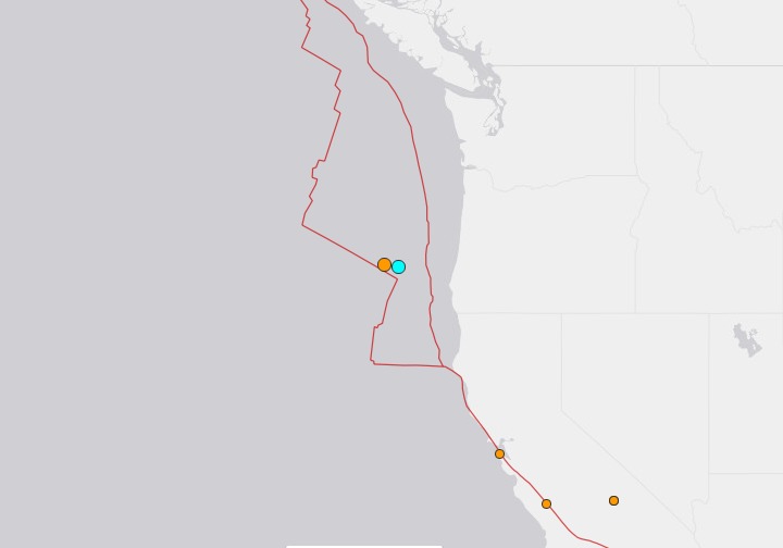
I spoke with a seismologist with the USGS and he said that area off the Oregon Coast is very active and they monitor these earthquakes all the time.
“These particular size quakes are not of concern.” – Seismologist USGS
When asked if these kinds of earthquakes could possibly cause a Tsunami the seismologist said no. There needs to be a much more violent vertical shift of the plates and they didn’t see any evidence of that.
So sleep easy Lincoln City. You won’t be washed away today.
The Lincoln City Parent Group (LCPG) is hosting a silent auction to raise funds to support Oceanlake and Taft Elementary schools. Money raised from the event will go towards art, music, sciences, teacher support, and classroom activities. The LCPG has used funds raised in the past for:
 Classroom supplies
Local items being auctioned – Bid on classroom baskets – Free appetizers – Winter fun activities
The silent auction will be held at Oceanlake Elementary Sunday, December 4 at 3 PM – 5 PM.
Oceanlake Elementary School – Click for directions.
2420 NE 22nd St, Lincoln City, Oregon 97367
Local web design and marketing company Tuned In Studios is giving away donation websites to those in need this holiday season. Donation websites have been growing in recent years with sites like GoFundme.com and YouCare.com almost doubling in size. Crowd funding is a relatively new concept that has caught on like wildfire.
There is a drawback to using these sites as the fees have become outlandish similar to what has happened to Ebay. People who genuinely need the money are being hit with 15% fees for using the service as well as having to pay 3% for the payment processing.
Tuned In Studios is offering to build donation websites that accept PayPal payments so the website owner will only be getting the 3% payment processing fee taken out of all donations. No fees for the service means 97% of the donation goes directly to the website owner.
When asked why Tuned In Studios was willing to give away thousands of dollars in website development fees they had this to say:
We are sick and tired of seeing companies like gofundme and the lot bilking people in need for funds that can be better spent on the people who actually need them. we have an opportunity to give back to the community and especially those who really need it and we are doing it because we can.
The web design firm manages many local websites including: Lil Sambos, Putt N Bat, Lincoln City Homepage, CPA Lincoln City, Captain Cook Inn, Loyd Butler Precision Painting, and a bunch more.
Website owners will need to secure a domain name ($10) and pay a yearly hosting fee of $50. That means any potential website owner will need to come up with $60 to get a website started. Security, social media pages, and marketing will all be handled by the company. The company will also train website owners on how to run the site and create engaging posts on social media.
This offer is good for residents of Lincoln City and families displaced due to medical reasons or other emergency.
tunedinstudios.com – 541-992-0321
The place was packed! Half of Lincoln City turned out to make ornaments, check out the sale, have their kids sit on Santa’s lap, watch the tree light up, and listen to the sound of the Sweet Adelines caroling. It was a fantastic atmosphere of friendship and true holiday spirit.
This reporter seriously believed a CD was playing Christmas music when I first walked in. It was the Sweet Adelines live and in person! They were phenomenal. What a gift to the people of Lincoln City.
Santa did a great job listening to the children and did an even better job handling the kids who cried when placed on his lap. That can’t be an easy job. Hats off to you Santa.
Lincoln City Mayor Don Williams lit up the tree and also lit up himself. He was wearing Christmas lights on his jacket! I have seen public officials do lots of things but that may be the coolest.
https://www.facebook.com/lchomepage/videos/1325549047517235/
Lincoln City Homepage is thankful for the support it has received from its users. People like you who visit this website. Thank you.
High winds and flooding are hitting the Central Oregon Coast.
