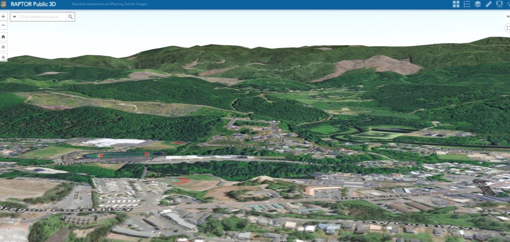
Oregon’s Office of Emergency Management’s Real-time Assessment and Planning Tool for Oregon (RAPTOR) is now available as a public version featuring 3D tools for weather alerts, traffic and live map data.
The program is a vital tool for statewide emergency managers, allowing access to live data in map layers. It’s also a handy resource for anyone interested in what’s happening with weather and traffic around the state. RAPTOR has been updated and now offers visuals in three dimensions.
“Presenting information in a 3D view is going to match more closely with what you can see when you walk outside your door, providing an in person view, and an exciting way to visualize the landscape, landmarks and current incidents,” OEM Program Coordinator Daniel Stoelb said.
Originally developed in 2010 to share information on a common operating picture as part of the U.S. Department of Homeland Security’s Virtual USA Northwest Pilot Project program, RAPTOR is a web-mapping application that allows users to display data from various resources onto a single map. The program supports OEM’s Emergency Operations Plan by sharing information before, during and after an event and enhances our overall readiness throughout the state.
In addition to 3D capabilities, the updated RAPTOR site allows users to share maps, and save or bookmark geographic locations. In addition, the site displays the OEM Twitter feed, offers a full-screen option and works on a variety of platforms including PC, Android and IOS.
To view the new public version of RAPTOR, go to https://arcg.is/08TCuO.


